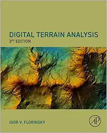
Digital Terrain Analysis, 3rd Edition (Original PDF from Publisher)
$35.00
Stay at the forefront of geospatial science with the 3rd Edition of Digital Terrain Analysis—a trusted, cutting-edge reference for understanding, modeling, and applying terrain data across environmental, hydrological, and engineering disciplines. Published by Elsevier in 2025, this extensively updated edition offers the latest methods, software tools, and applications in one definitive resource.
Description
Digital Terrain Analysis (3rd Edition) is a comprehensive guide to the theory and practice of analyzing terrain surfaces using digital elevation data. Designed for geographers, GIS specialists, earth scientists, civil engineers, and environmental researchers, this book combines foundational concepts with modern computational techniques to support real-world applications in fields like hydrology, land-use planning, and hazard assessment.
This edition reflects the latest advancements in digital elevation modeling (DEM), remote sensing, open-source tools, and automated terrain feature extraction—making it ideal for both academic study and professional use.
Key Features & Highlights
- Fully updated content reflecting technological progress in DEM generation, LiDAR processing, and 3D modeling
- Detailed discussion of terrain parameters, landform classification, and geomorphometric analysis
- Applications across hydrological modeling, landslide prediction, urban planning, and environmental monitoring
- Covers both commercial GIS software and open-source platforms (e.g., GRASS GIS, SAGA, QGIS)
- Step-by-step examples and case studies for practical implementation
- Written by leading experts in terrain analysis and geospatial science
Topics & Chapters
Includes core chapters on:
- Digital elevation models (DEMs) and data sources
- Terrain attributes and morphometric parameters
- Watershed and drainage network analysis
- Slope, aspect, curvature, and topographic indices
- Multi-scale terrain representation and feature extraction
- Integration of LiDAR, radar, and photogrammetry data
- Terrain analysis in climate, soil, and ecological applications
About the Author
The authors are internationally recognized scholars in geomorphology, GIS, and terrain analysis, with decades of combined experience in academic research and applied geospatial projects. Their contributions are widely cited across environmental science and spatial data modeling literature.
Technical Details
- Format: Original PDF (from Elsevier Publisher)
- Edition: 3rd Edition
- Year of Publication: 2025
- Language: English
- File Size: Approximately 35–40 MB
- Device Compatibility: Compatible with all major devices – Windows, macOS, iOS, Android, tablets
- DRM-Free: Yes – unrestricted use for personal and academic reference
Frequently Asked Questions (FAQs)
1. Is this book suitable for students learning GIS and terrain modeling?
Yes, the book is structured to support both beginners and advanced users. It provides theoretical foundations alongside practical examples, making it ideal for university courses, lab work, and individual study.
2. Does the book include methods using open-source GIS tools?
Absolutely. The 3rd Edition covers popular open-source platforms like QGIS, GRASS GIS, and SAGA, with examples showing how to apply terrain analysis techniques without commercial software.
Additional information
| Publisher |
Elsevier |
|---|---|
| Published Year |
2025 |
| Language |
English |
| ISBN |
978-0443247989, 9780443247996 |
| File Size |
153.2 MB |
| Edition |
3 |


Reviews
There are no reviews yet.